See What Ground-Level Inspections Miss
Aerial Property Intelligence Reviews for property owners, HOA boards, and property management companies.
Using FAA-certified drone technology and property operations expertise, we help clients identify visible maintenance concerns, document property conditions, improve visibility, and make better property decisions.
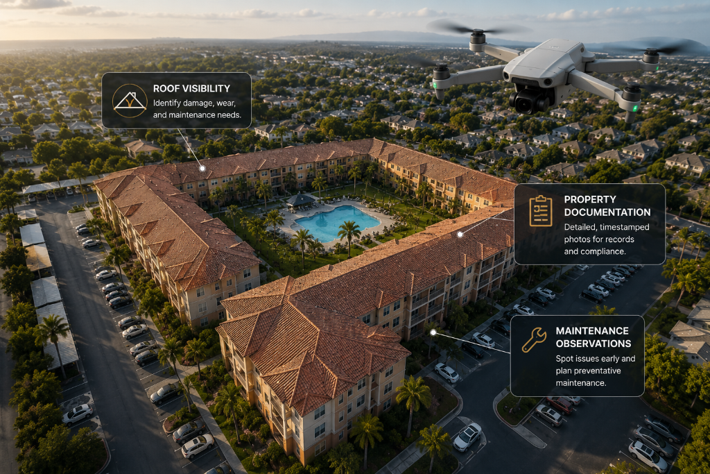
Limited Availability
Complimentary Aerial Property Intelligence Review
For a limited number of qualified property owners and property management companies.
What's Included
Capabilities
Why Aerial Property Intelligence?
Many property issues begin in areas that are difficult, expensive, or unsafe to inspect from the ground.
Roof Condition Visibility
Gain aerial perspectives on roof surfaces, membranes, flashing, and drainage components that are invisible from ground level.
Drainage & Water Pooling
Identify potential water pooling, drainage flow patterns, and moisture-related concerns across roofs and hardscape.
Exterior Building Documentation
Document façade conditions, siding, paint, balconies, and exterior building elements with precision aerial imagery.
Tree & Vegetation Assessments
Assess tree canopy proximity to structures, overgrowth concerns, and vegetation health across the property.
Parking Lot & Pavement Reviews
Review pavement condition, striping, drainage, and surface deterioration across parking areas and walkways.
Construction Progress Documentation
Track renovation and construction projects over time with consistent aerial documentation and progress records.
Insurance & Damage Documentation
Create visual records of property conditions before and after damage events for insurance and restoration purposes.
Property Marketing Imagery
Produce high-quality aerial photography for listings, investor presentations, and marketing collateral.
Our Services
Aerial Property Intelligence Services
HOA Property Reviews
Support HOA boards and community managers with aerial visibility into roofs, common areas, drainage, trees, and exterior assets.
Apartment & Multifamily Reviews
Help property managers and owners document building conditions, identify visible maintenance concerns, and improve portfolio visibility.
Roof & Exterior Visibility Reviews
Provide aerial views of roofs, gutters, exterior surfaces, and hard-to-see areas for better decision-making.
Insurance & Damage Documentation
Support condition documentation before and after storm, leak, water intrusion, or damage events.
Construction Progress Monitoring
Track renovations, capital improvements, and construction projects over time with consistent aerial documentation.
Real Estate Marketing Photography
Provide professional aerial imagery for property listings, investor presentations, and marketing materials.
Deliverable
Property Intelligence Summary Report
Clients receive more than images. They receive organized visual documentation and practical observations.
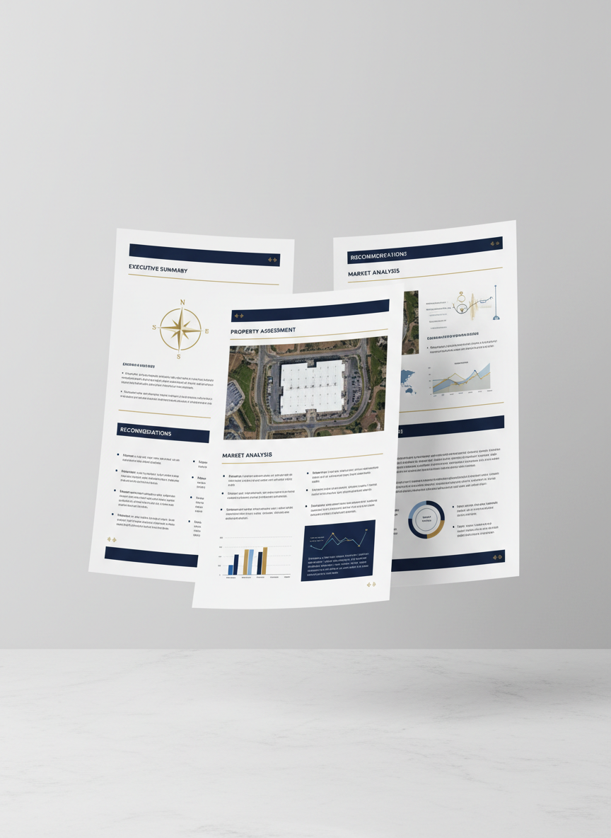
Executive Summary
High-level overview of findings and key observations.
Property Overview
Property details, location context, and scope of review.
Aerial Images
Organized aerial photography with annotations and context.
Observations
Documented visual observations across all reviewed areas.
Potential Concerns
Identified areas that may warrant further professional review.
Recommended Next Steps
Practical guidance for follow-up actions and priorities.
The report is designed to help owners, managers, boards, and vendors better understand property conditions and next steps.
Industries
Who We Help
Property Management Companies
Improve portfolio visibility and document property conditions across managed assets.
HOA Management Companies
Support board reporting with aerial documentation of common areas, roofs, and community assets.
Apartment Owners
Identify visible maintenance concerns and document building conditions for smarter capital planning.
Commercial Property Owners
Gain aerial visibility into roofs, parking areas, and exterior assets across commercial properties.
Real Estate Investors
Perform aerial due diligence and condition assessments before acquisition or during hold periods.
Roofing Companies
Provide clients with professional aerial documentation to support scoping and proposals.
Insurance Restoration Companies
Document pre- and post-event conditions for insurance claims and restoration projects.
Smart System & Security Installers
Assess property layouts for security camera, access control, and smart system installations.
Real-World Application
Example Use Case
Aerial visibility can reveal issues that may not be obvious from the ground.
During a recent residential property review, aerial images helped identify visible roof concerns that were not easily seen from ground level. The owner was able to investigate the issue before it became a larger maintenance problem.
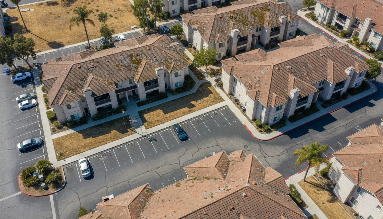
Aerial Property View
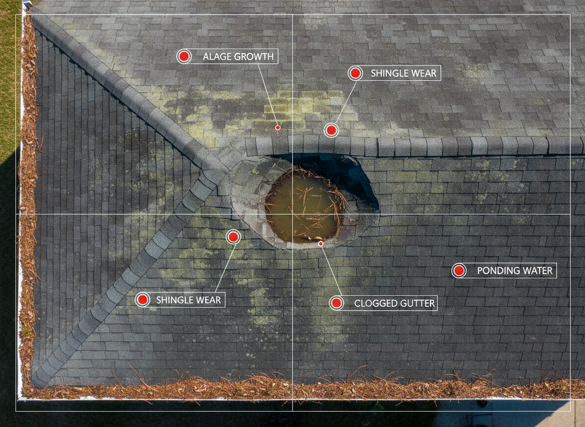
Roof Concern Identified
Summary Report Delivered
Our Difference
More Than Drone Photography
Most drone operators provide images. SmartProp Advisor combines aerial technology with property operations, risk awareness, preventive maintenance thinking, and business consulting experience.
Drone Photography
- Photos and videos
Aerial Property Intelligence
- Visual documentation
- Property observations
- Summary report
SmartProp Advisor
- Property intelligence
- Operational insight
- Risk visibility
- Better decision-making
Proprietary Approach
Our goal is not simply to capture images. Our goal is to help clients make better property decisions.

Leadership
Led by Dr. Ali Asadi
Dr. Ali Asadi, DBA, PE, is a Property Operations & Intelligence Advisor, FAA Part 107 Certified Remote Pilot, and Founder of SmartProp Hub.
With more than 20 years of business, technology, operations, and consulting experience, Dr. Asadi helps property owners and management companies improve visibility, reduce risk, and make smarter property decisions.
Common Questions
Frequently Asked Questions
Important Disclaimer
Aerial Property Intelligence Reviews are visual documentation and observation services. They do not replace licensed roof inspections, structural engineering inspections, insurance inspections, legal advice, or contractor evaluations. Clients should consult qualified professionals for repair decisions, code compliance, insurance claims, or structural concerns.
Ready to Gain a Better View of Your Property?
Request a complimentary Aerial Property Intelligence Review and discover what ground-level inspections may miss.
Dr. Ali Asadi
Property Operations & Intelligence Advisor · FAA Part 107 Certified Remote Pilot